File:Villageville Map.png
Size of this preview: 800 × 578 pixels. Other resolutions: 2,560 × 1,849 pixels | 3,240 × 2,340 pixels.
Original file (3,240 × 2,340 pixels, file size: 668 KB, MIME type: image/png)
Summary
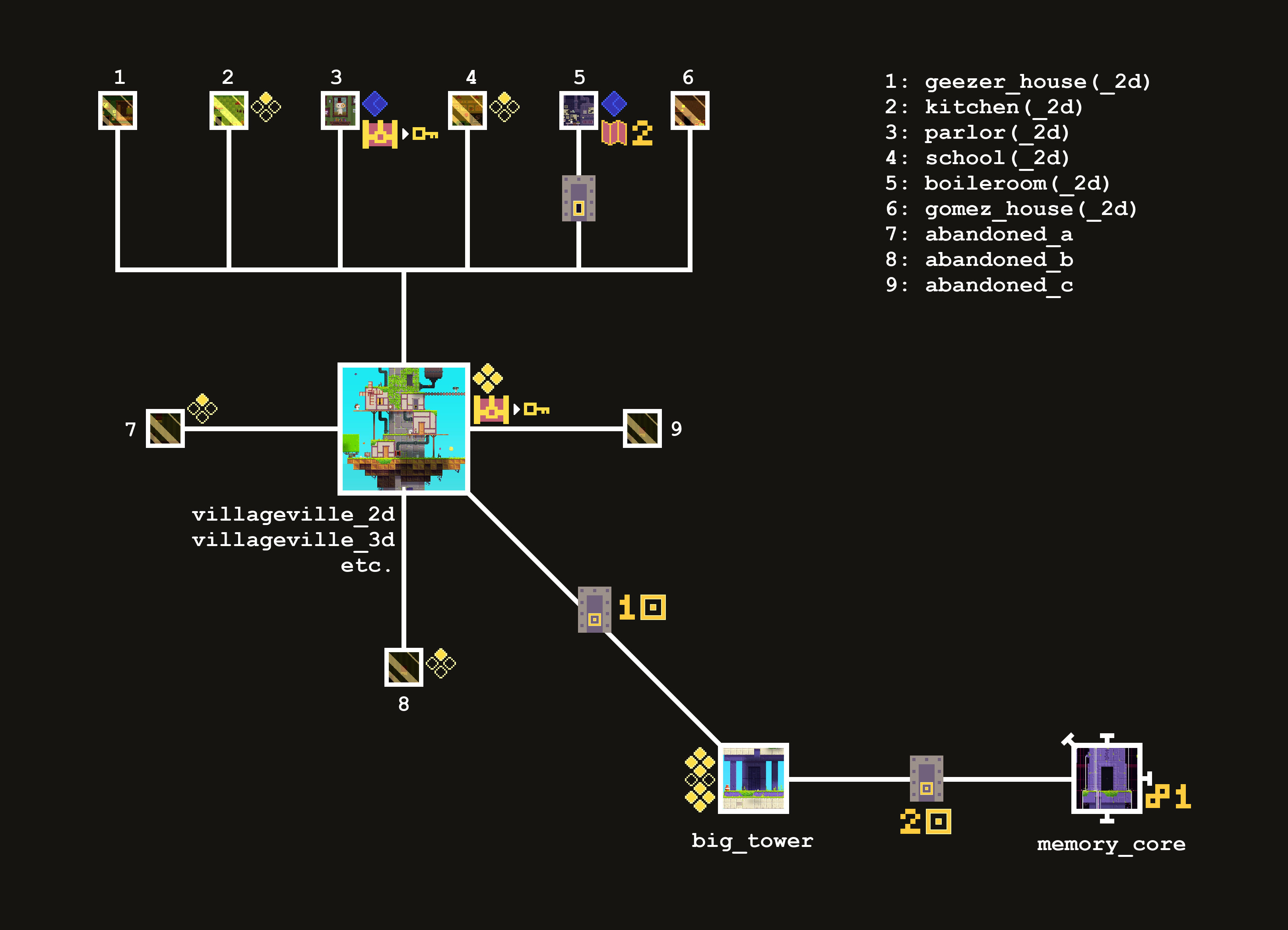
Map of Villageville in a 2D plane. Created by Wertuias12
File history
Click on a date/time to view the file as it appeared at that time.
| Date/Time | Thumbnail | Dimensions | User | Comment | |
|---|---|---|---|---|---|
| current | 02:50, 9 July 2025 | | 3,240 × 2,340 (668 KB) | Hyphernando (talk | contribs) | Map of Villageville in a 2D plane. Created by Wertuias12 |
You cannot overwrite this file.
File usage
The following page uses this file: