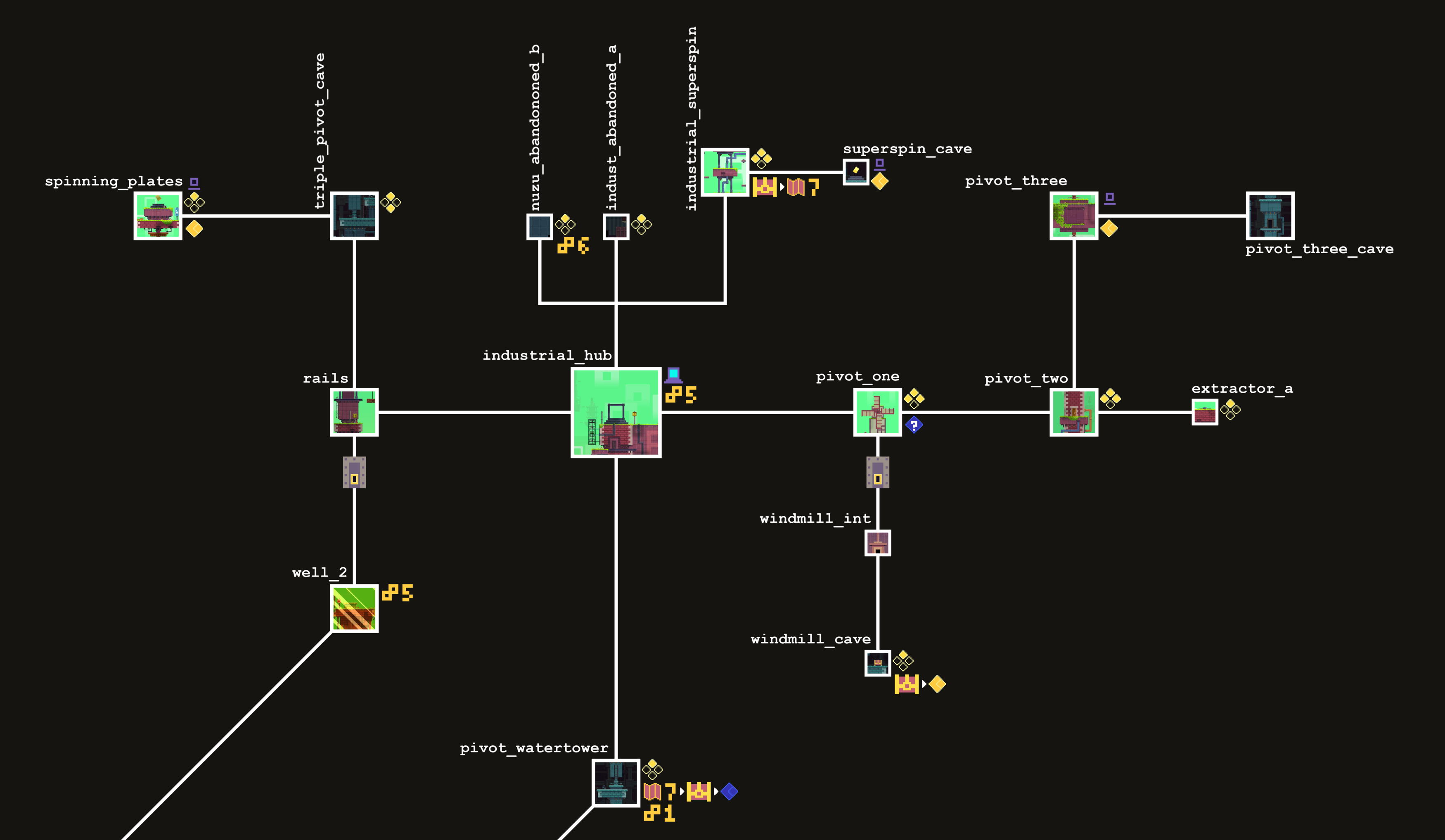
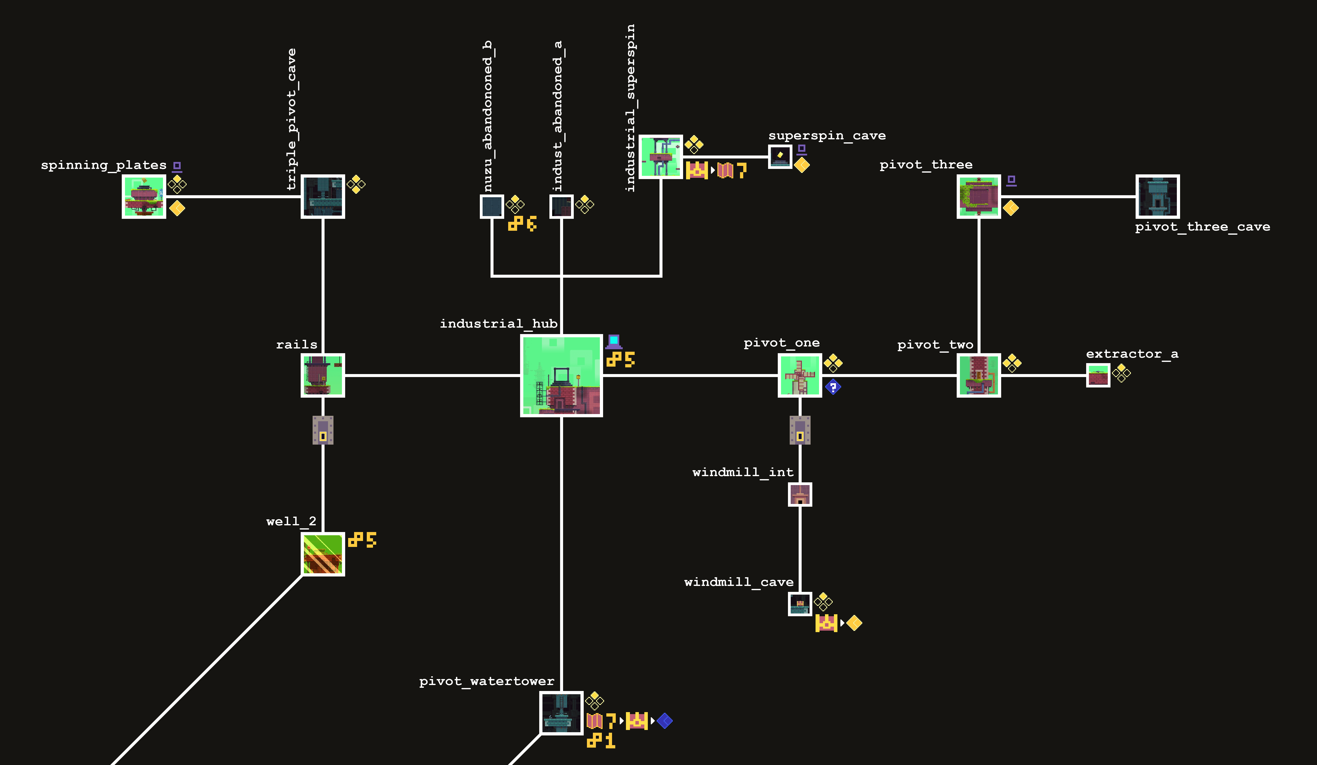
File:Industrial Hub Map.png
Size of this preview: 800 × 465 pixels. Other resolution: 3,500 × 2,034 pixels.
Original file (3,500 × 2,034 pixels, file size: 486 KB, MIME type: image/png)
Summary
Map of the Industrial Hub in a 2D plane. Created by Wertuias12
File history
Click on a date/time to view the file as it appeared at that time.
| Date/Time | Thumbnail | Dimensions | User | Comment | |
|---|---|---|---|---|---|
| current | 04:38, 9 July 2025 | | 3,500 × 2,034 (486 KB) | Hyphernando (talk | contribs) | |
| 03:01, 9 July 2025 | Error creating thumbnail: File with dimensions greater than 12.5 MP | 5,300 × 3,080 (227 KB) | Hyphernando (talk | contribs) | Map of the Industrial Hub in a 2D plane. Created by Wertuias12 |
You cannot overwrite this file.
File usage
The following 2 pages use this file: